When Seconds Count: Aerial Intelligence for Rapid Response & Rescue
When seconds count, EagleReach delivers real-time aerial intelligence that enhances safety, coordination, and decision-making for first responders. Our drone teams are trained to operate in high-stress environments, providing fast, accurate data to support missions on the ground.
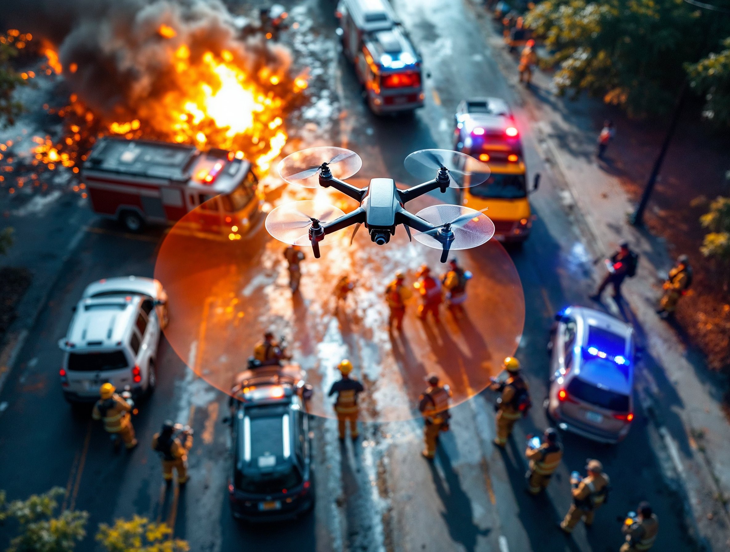
- Rapid Aerial Situational Awareness:
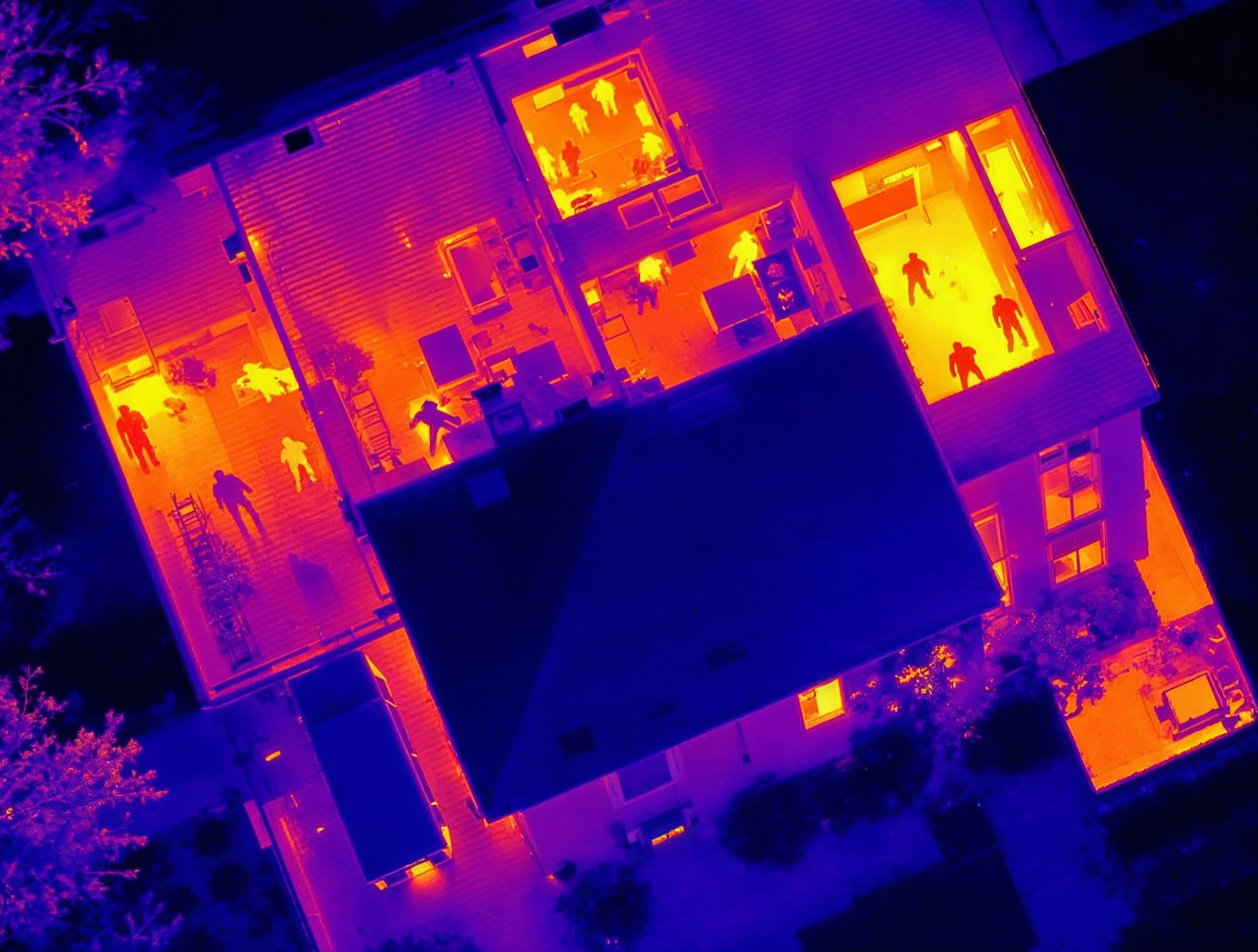
Get immediate overhead views during fires, search & rescue missions, traffic incidents, or disaster zones—helping commanders deploy resources where they’re needed most. - Thermal Imaging & Live-Stream Support:
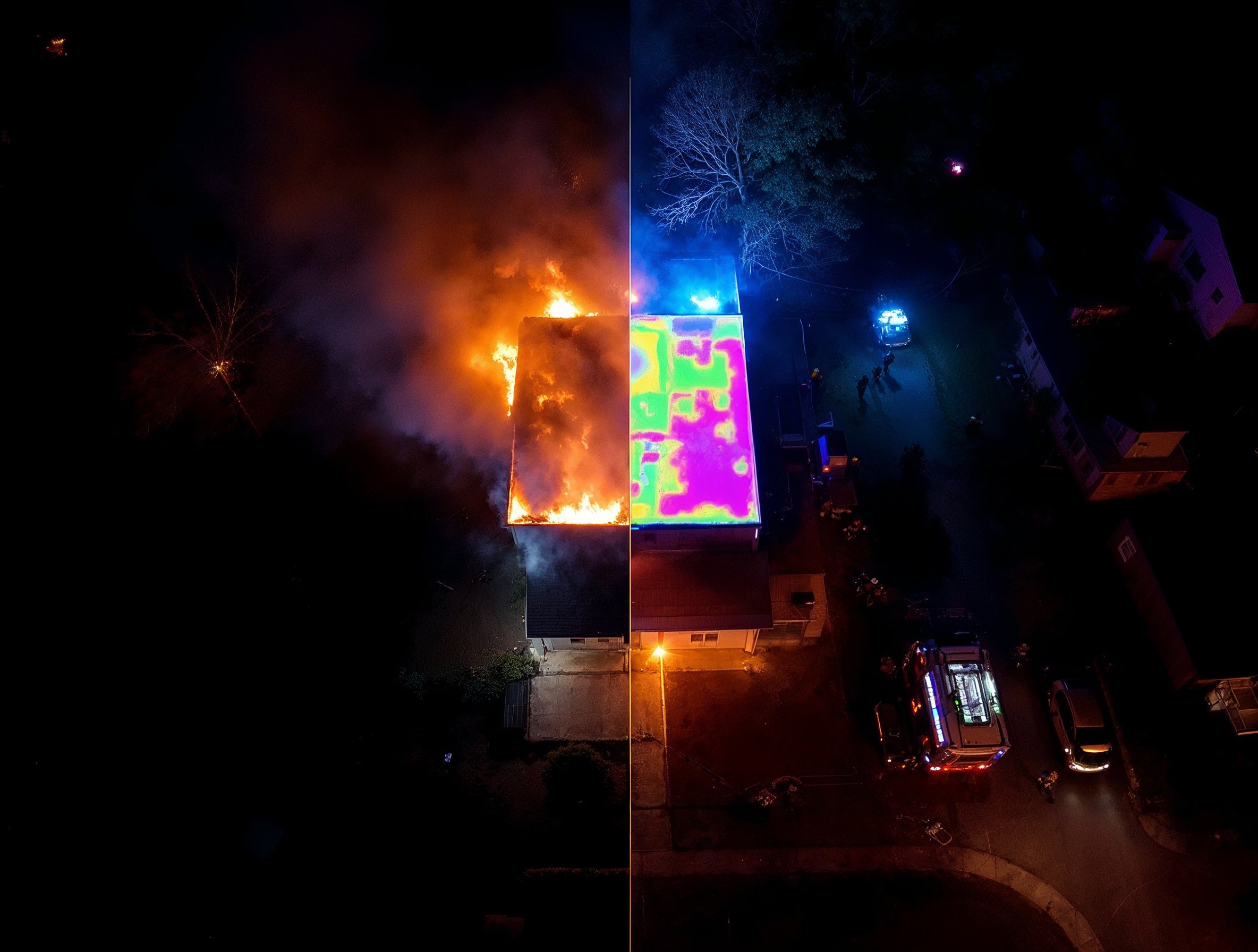
Identify heat signatures through smoke, darkness, or debris. Our drones can stream live footage directly to command units or mobile devices for informed real-time action. - Search & Rescue Operations:
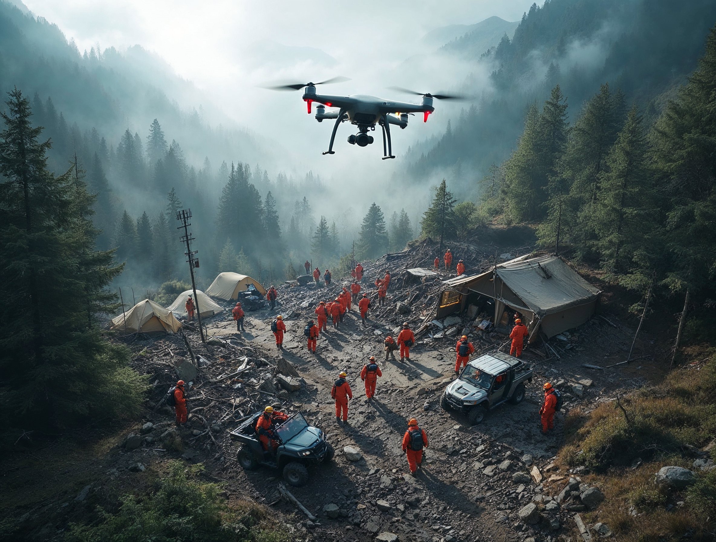
Cover large areas quickly in remote, wooded, or rugged terrain. Pinpoint missing persons with visual and thermal imagery, GPS tagging, and route tracking. - Post-Incident Documentation:
Capture time-stamped aerial imagery for accident reconstruction, scene analysis, or insurance and legal purposes. - Warrant Operations & Tactical Overwatch:
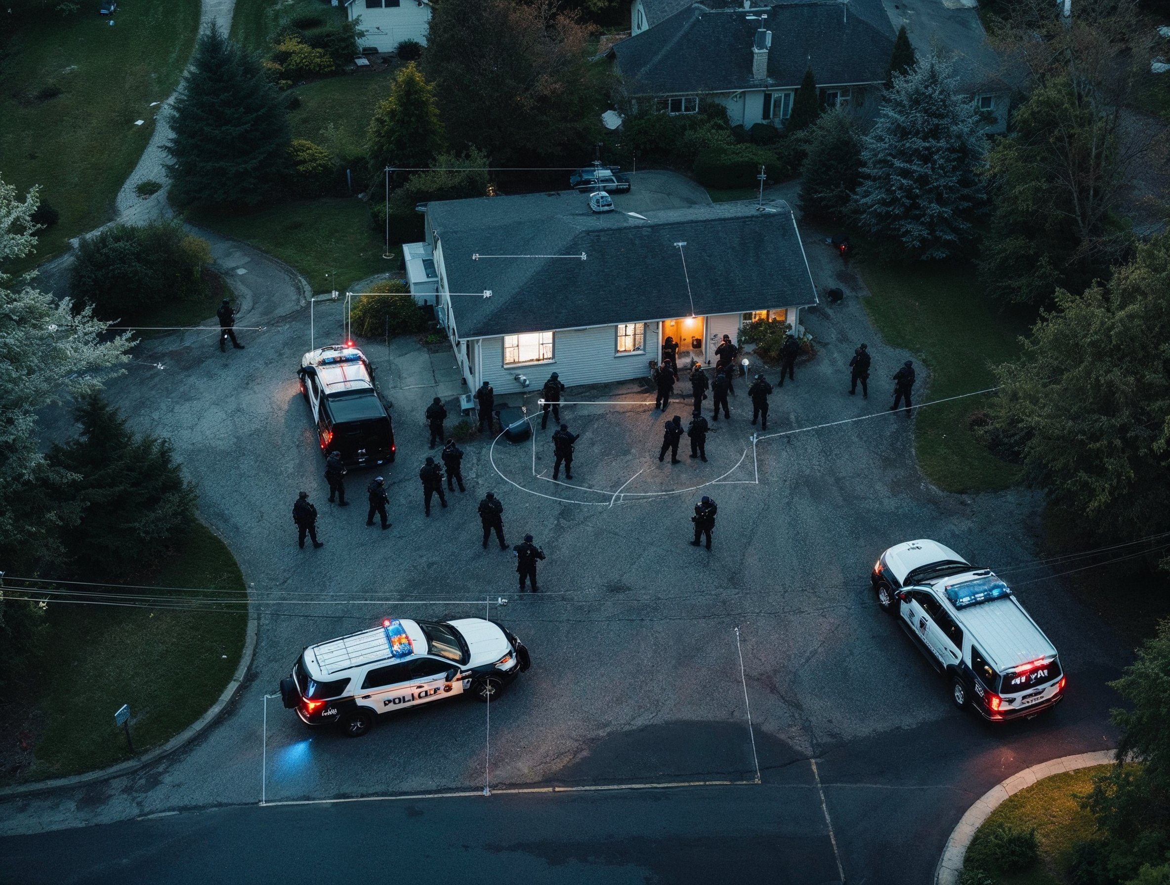
Support law enforcement with discreet aerial surveillance before, during, and after warrant service. Live thermal and visual feeds enhance situational awareness, occupant detection, and perimeter control—improving safety and operational success.
Whether you’re serving a rural fire district, county emergency management team, or urban law enforcement unit, EagleReach brings an experienced, mission-ready mindset to every flight—so your team can see the full picture, safely and fast.